Kanchenjunga Base Camp Trek (18 Days) — Kathmandu to Kathmandu, Nepal

Kanchenjunga Base Camp Trek — Overview
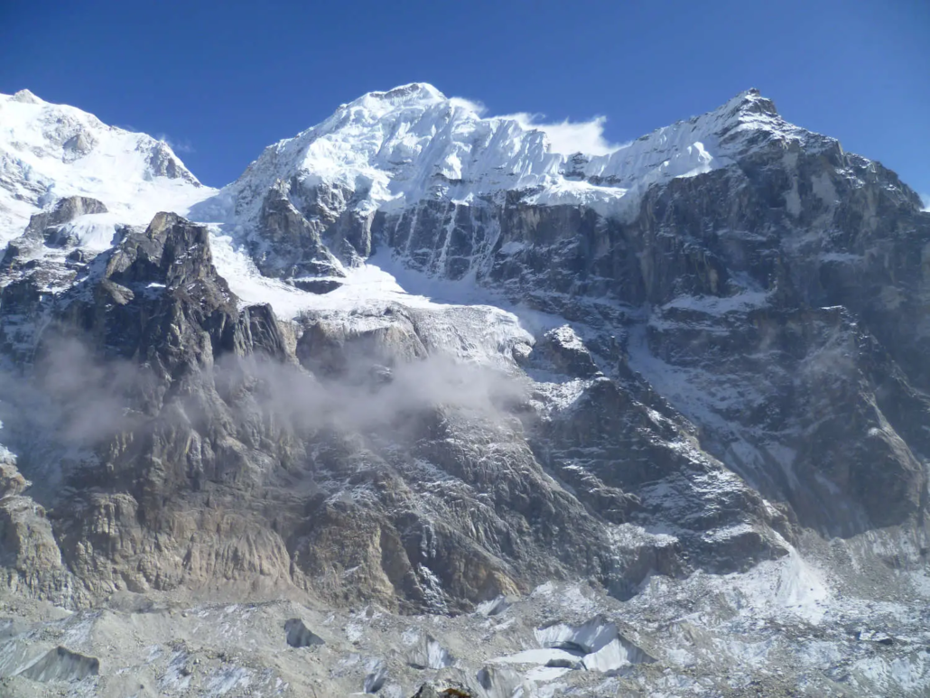
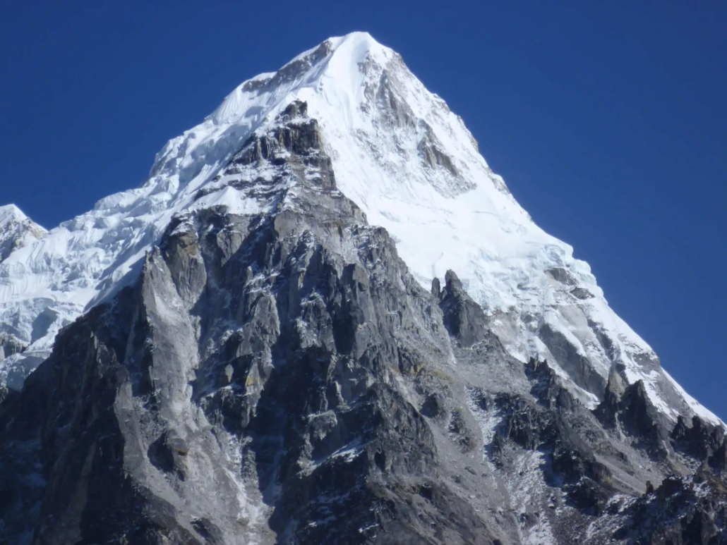
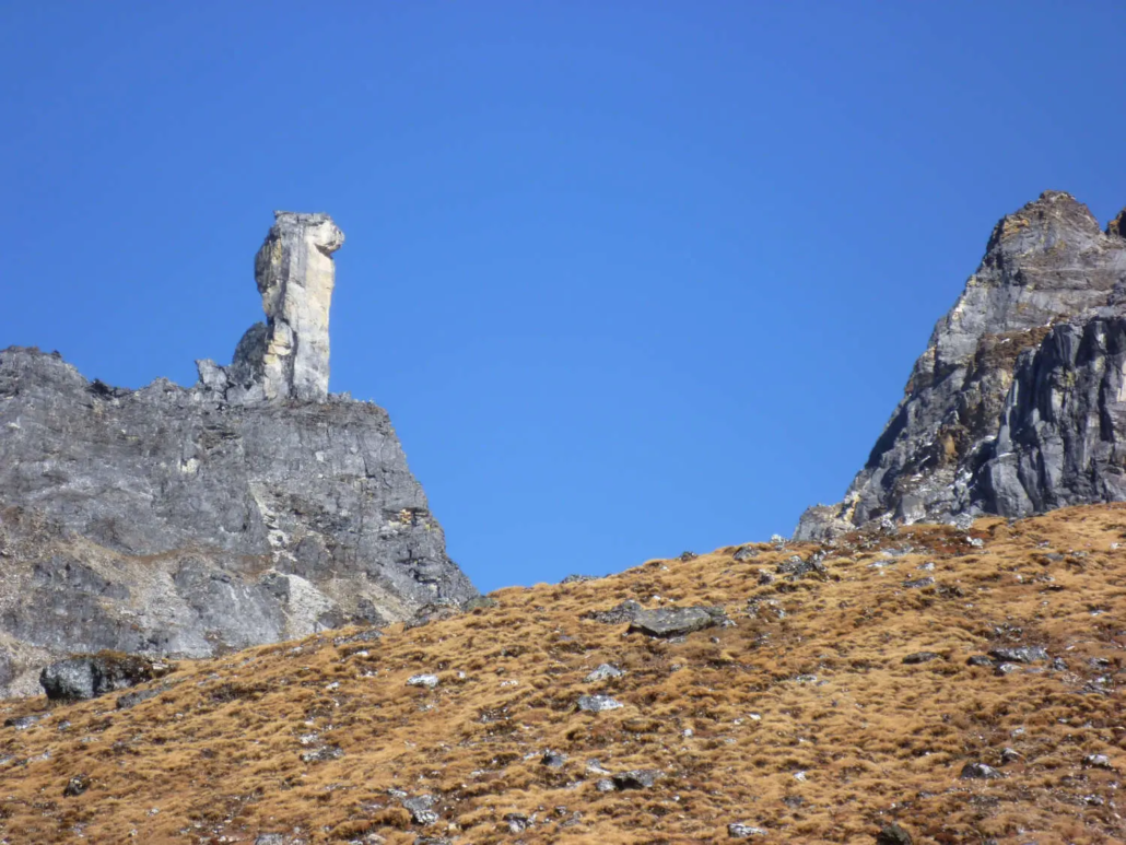
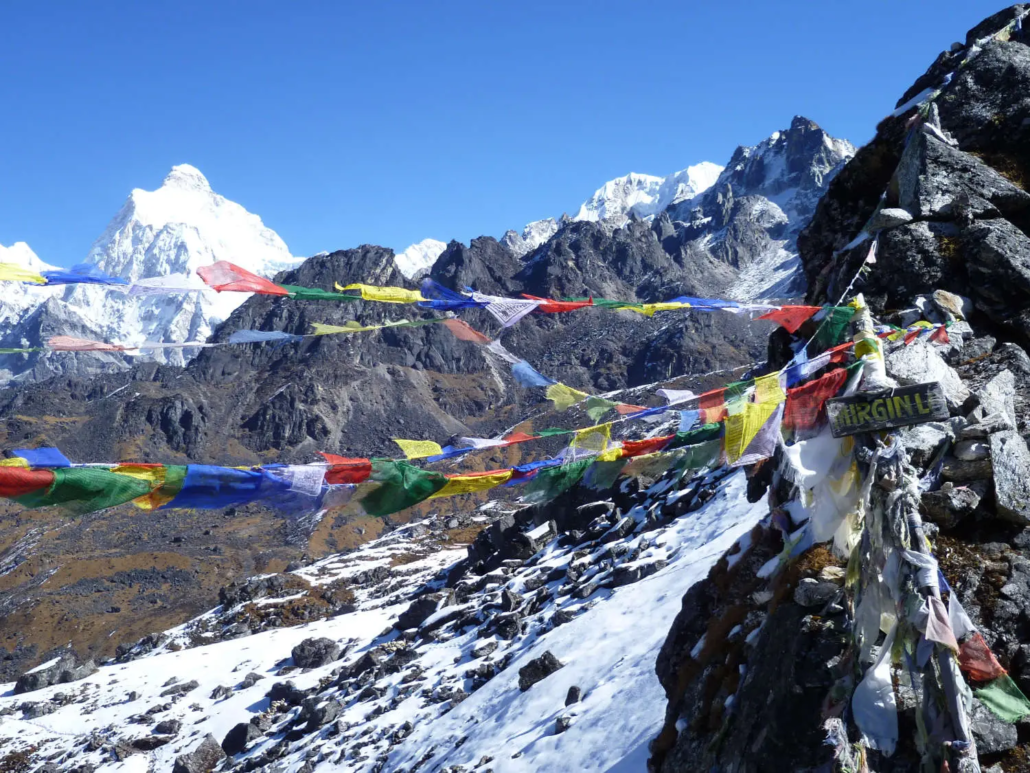
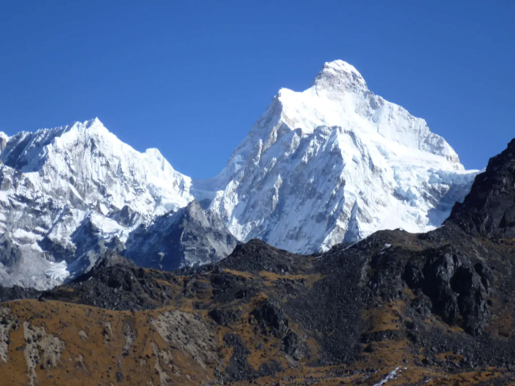
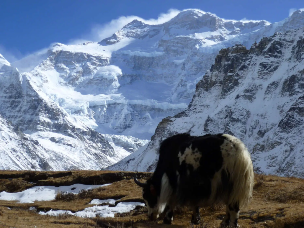
Kanchenjunga (8,586m) is the third-highest mountain on earth, and it is the least visited of the Himalayan giants. The 18-day trek to its North Base Camp at Pangpema (5,143m) is one of the most rewarding long-distance routes in Nepal — a genuine wilderness journey through the restricted eastern Himalaya where yak trains outnumber trekkers, rhododendron forests give way to moraine-studded glaciers, and the Kanchenjunga massif fills the sky with five summits above 8,400m visible simultaneously from a single viewpoint. From Pangpema, the panorama of Kanchenjunga Main (8,586m), Kanchenjunga West (8,505m), Kanchenjunga Central (8,482m), Kanchenjunga South (8,476m), and Yalung Kang (8,505m) across the Yamatari Glacier is unlike anything available from any other non-technical trekking route in Nepal.
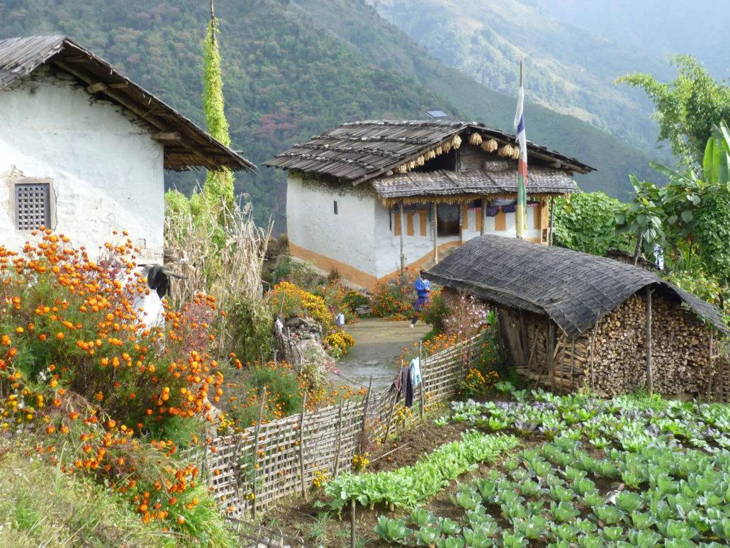
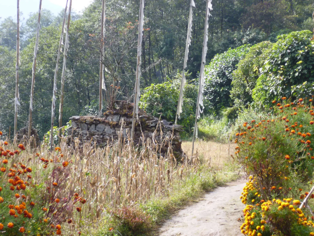
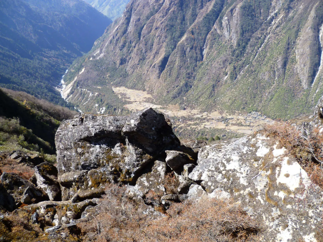
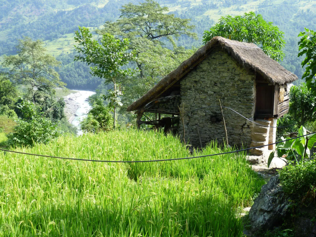
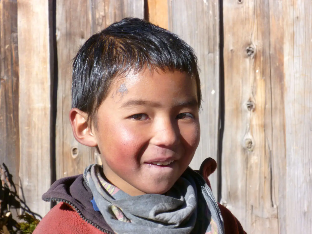
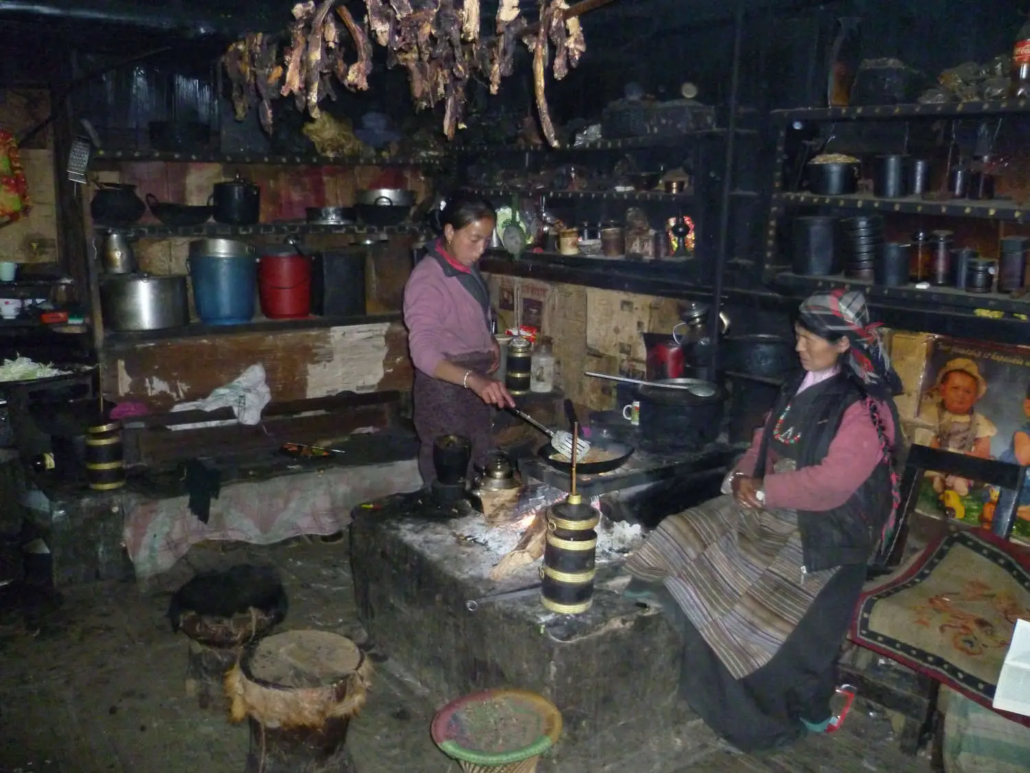
This is not a teahouse highway. Kanchenjunga receives fewer trekkers in a full season than Everest Base Camp receives in a single week. The route from Taplejung (2,420m) through the deep Limbu and Rai river valleys of eastern Nepal to the Tibetan Buddhist settlement of Ghunsa (3,595m) and on to Pangpema is culturally, geographically, and experientially unlike anything on the Khumbu or Annapurna circuits. The lower valleys are the ancestral homeland of the Limbu people — one of Nepal’s oldest ethnic groups, with a distinct language, animist-Buddhist tradition, and deeply rooted mountain culture that predates trekking tourism by centuries. The cultural immersion on this trek is as significant as the mountain scenery.
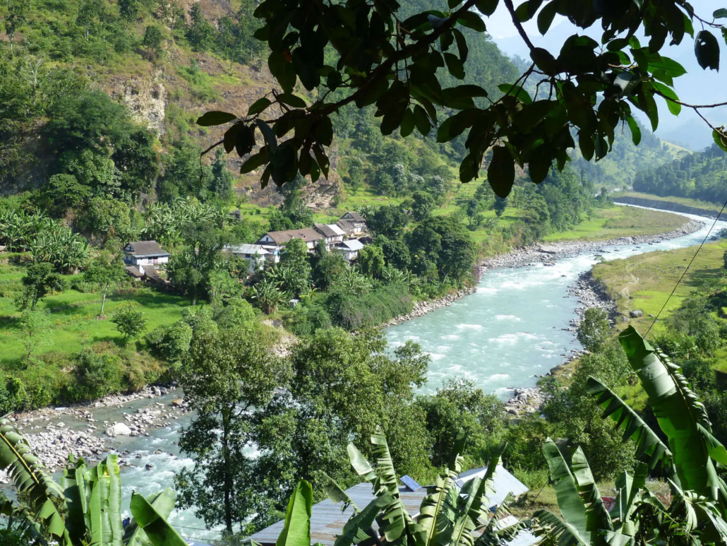
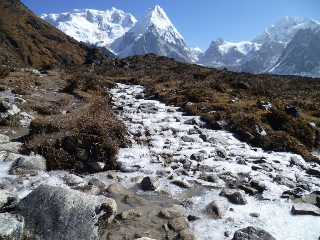
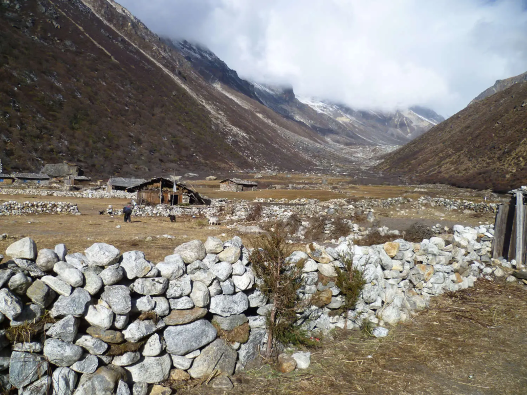
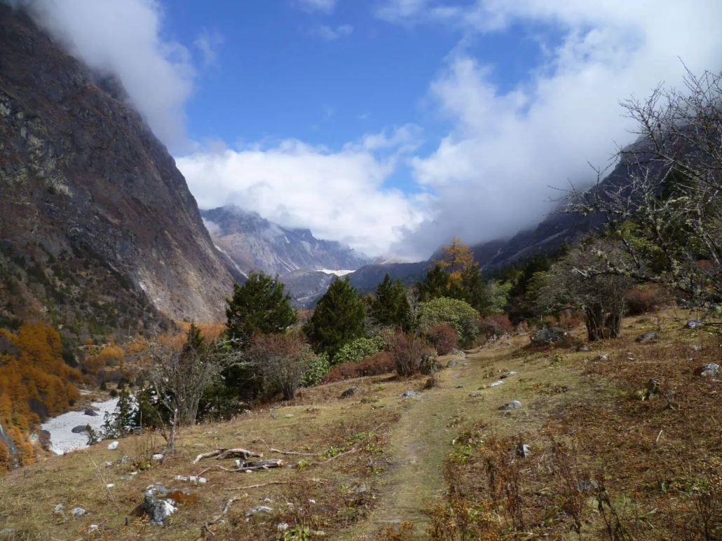
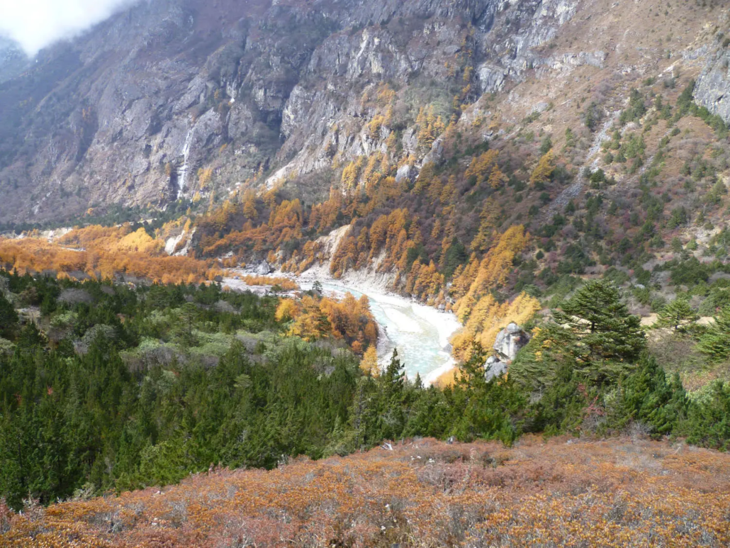
The route flies from Kathmandu to Suketar Airport (2,420m), above the market town of Taplejung in the far east of Nepal, then descends into the Tamor River valley before turning north up the Ghunsa Khola through Limbu villages, dense rhododendron forest, and increasingly remote terrain to Ghunsa — the last permanent settlement before the high glacier zone. Above Ghunsa, the valley transforms into a world of glacial moraine, yak pasture, and towering granite walls, culminating in the North Base Camp at Pangpema. A full rest day at base camp is built into the itinerary before the long return descent and the flight back to Kathmandu.
The route requires a Restricted Area Permit in addition to the Kanchenjunga Conservation Area Permit. Independent trekking is not permitted — a licensed guide is mandatory. Summit Routes provides a Limbu-speaking licensed guide and full porter team, and arranges all permits before departure. For trekkers who have completed EBC or Annapurna and are looking for something rawer, more remote, and genuinely less travelled, Kanchenjunga is the answer.
Important Notes
- Best Seasons: March–May (spring) and September–November (autumn). Spring brings rhododendron in extraordinary bloom across the mid-altitude forest sections between Gyabla and Ghunsa — the ridgelines between 2,500m and 3,600m are among the finest rhododendron environments in Nepal, with multiple species flowering simultaneously in April. Autumn offers the clearest mountain visibility and the most settled conditions for the high glacier sections above Kambachen, with October providing the sharpest views of the full Kanchenjunga massif from Pangpema.
- Trek Grade: Challenging — the combination of daily distances (up to 22 km on the return descent), sustained altitude above 4,000m for four consecutive nights, very remote terrain with limited evacuation options above Ghunsa, and genuinely basic accommodation conditions above Kambachen makes this the most demanding trek in the Summit Routes Nepal portfolio. No technical climbing is involved. Trekkers should have prior multi-day trekking experience above 4,000m before considering this route.
- Highest Point: Pangpema — Kanchenjunga North Base Camp (5,143m) on Day 11. Optional ridge hike above Pangpema to approximately 5,400m on Day 12 for fit trekkers at the guide’s assessment.
- Highest Night: Pangpema (5,143m) — two consecutive nights (Days 11 and 12).
- Restricted Area Permit: Kanchenjunga requires both a Restricted Area Permit (RAP) and a Kanchenjunga Conservation Area Permit (KCAP). Independent trekking without a licensed guide is not permitted under any circumstances. Summit Routes arranges both permits before departure. See our permits and visa guide for full details.
- Suketar Flight Note: Suketar Airport serves Taplejung and is weather-dependent — more so than Lukla. Morning flights only; afternoon winds regularly cause cancellations. A Day 17 overnight in Kathmandu is built in as a buffer before the international departure on Day 18. Trekkers with tight onward connections should discuss this with Summit Routes before booking.
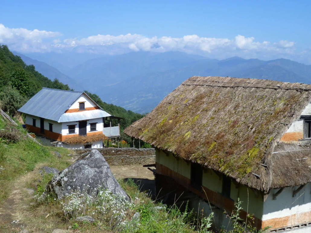
- Accommodation: Mixed — hotels in Kathmandu and a local lodge in Taplejung; tea houses along the lower and mid-valley sections; basic tea house shelters or expedition tents at Lhonak and Pangpema. The gap between the best tea house on this route (Ghunsa) and the accommodation at Pangpema is significant. This is remote Nepal; conditions above Kambachen are wilderness standard.
- Fitness Standard: Must be comfortable trekking 10–22 km daily across multiple consecutive days with significant elevation gain and loss. The Day 15 return from Ghunsa to Sekathum (22 km, sustained descent) is the longest single day. Prior high-altitude trekking experience above 4,000m — ideally including nights above 4,500m — is strongly recommended before attempting this route.
- Altitude: The route spends four consecutive nights above 4,000m, including two nights at 5,143m. Altitude sickness is a serious and less manageable risk on this route than on Khumbu or Annapurna circuits, primarily because helicopter evacuation above Ghunsa is significantly more difficult and weather-dependent. Read our guide to altitude sickness in the Himalaya before booking.
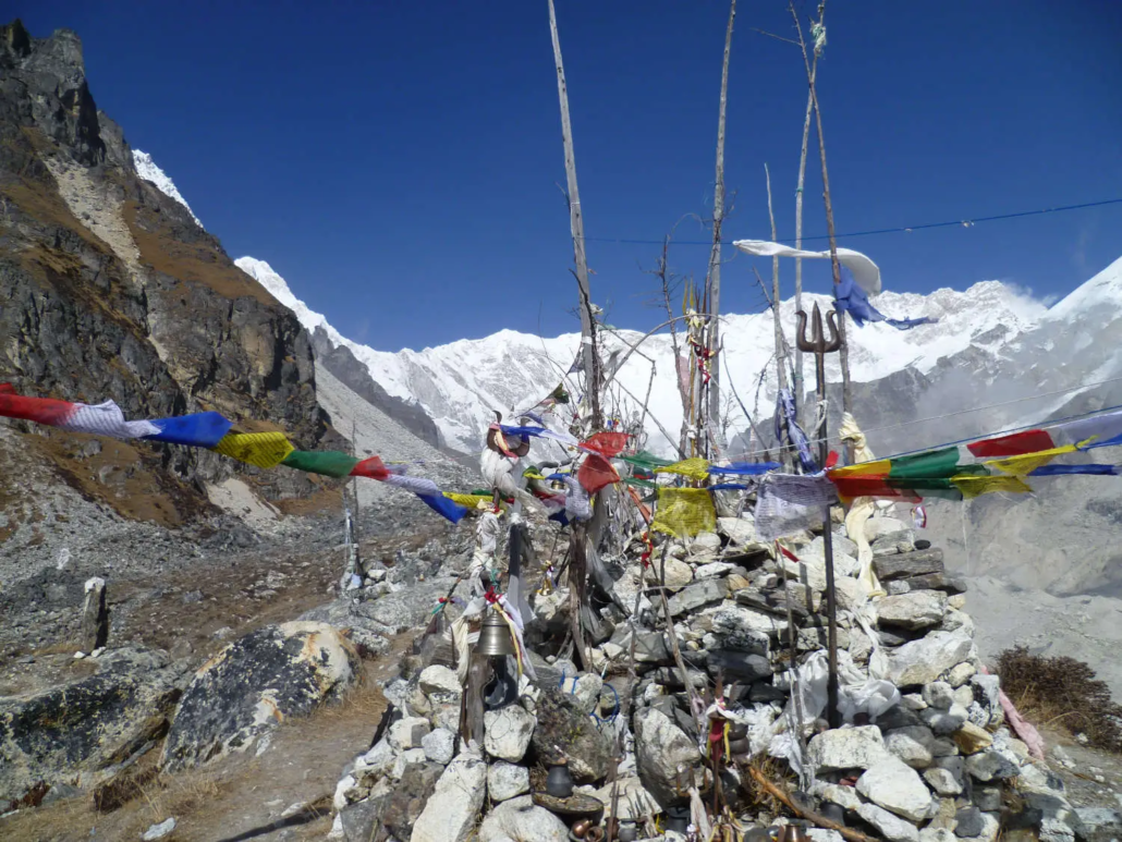
- Cultural Note: The lower Kanchenjunga valleys are the ancestral homeland of the Limbu and Rai peoples. Upper valley settlements above Ghunsa are Tibetan Buddhist communities with active monasteries. Trekkers are expected to dress respectfully, walk clockwise around all mani walls and chortens, ask before photographing people and religious sites, and behave with particular restraint within the Ghunsa gompa complex. This is a restricted area that has been protected from mass tourism; the responsibility that comes with that access is real.
Brief Itinerary
| Day 1 | Arrive Kathmandu (1,400m) — Orientation & Permit Preparation |
| Day 2 | Fly Kathmandu to Suketar / Taplejung (2,420m) |
| Day 3 | Trek Taplejung to Chirwa (1,270m) |
| Day 4 | Trek Chirwa to Sekathum (1,660m) |
| Day 5 | Trek Sekathum to Amjilassa (2,490m) |
| Day 6 | Trek Amjilassa to Gyabla (2,730m) |
| Day 7 | Trek Gyabla to Ghunsa (3,595m) |
| Day 8 | Acclimatisation Day at Ghunsa — Hike to Rampuk Kharka (4,200m) |
| Day 9 | Trek Ghunsa to Kambachen (4,050m) |
| Day 10 | Trek Kambachen to Lhonak (4,780m) |
| Day 11 | Trek to Pangpema — North Base Camp (5,143m) |
| Day 12 | Rest & Exploration at Pangpema — Yamatari Glacier |
| Day 13 | Trek Pangpema to Kambachen (4,050m) |
| Day 14 | Trek Kambachen to Ghunsa (3,595m) |
| Day 15 | Trek Ghunsa to Sekathum (1,660m) |
| Day 16 | Trek Sekathum to Taplejung / Suketar (2,420m) |
| Day 17 | Fly Suketar to Kathmandu — Overnight Kathmandu |
| Day 18 | Departure from Kathmandu |
Altitude Profile
Kanchenjunga Base Camp Trek — 18-Day Itinerary (Kathmandu to Kathmandu)
Route: Kathmandu — Suketar/Taplejung — Chirwa — Sekathum — Amjilassa — Gyabla — Ghunsa — Kambachen — Lhonak — Pangpema — Kambachen — Ghunsa — Sekathum — Taplejung — Kathmandu
Day 1: Arrive Kathmandu (1,400m) — Orientation & Permit Preparation
- Arrive at Tribhuvan International Airport (KTM) and private transfer to hotel in Thamel.
- Afternoon reserved for permit processing — your guide will coordinate the Restricted Area Permit (RAP), Kanchenjunga Conservation Area Permit (KCAP), and TIMS Card. Both permits must be in hand before the trek departs Taplejung; this is not a formality but a legal requirement for entry into the restricted zone.
- Evening trek briefing: 18-day route overview, altitude profile, acclimatisation strategy, the restricted area protocol, tea house and camp logistics, and what to expect on the high glacier sections above Kambachen.
- Optional walk around Thamel for last-minute gear or currency exchange.
- Overnight: Hotel Amaryllis or similar, Kathmandu
- Meals: Dinner
Day 2: Fly Kathmandu to Suketar / Taplejung (2,420m)
Flight: ~55 minutes to Suketar Airport
- Morning flight to Suketar Airport (2,420m) — the gateway to the Kanchenjunga region in Nepal's far east. The approach over the Himalayan foothills is spectacular; on clear mornings the Kanchenjunga massif itself is visible on the eastern horizon from the aircraft.
- Suketar sits on a ridge above the market town of Taplejung — a different Nepal entirely from Kathmandu. Eastern Nepal is less visited, culturally richer in Limbu and Rai heritage, and geographically distinct from both the Khumbu and the Annapurna regions. The pace of life is slower; the mountain that defines this landscape is, by any measure, one of the most extraordinary on earth.
- Afternoon walk through Taplejung to orientate, meet the full guide and porter team, and review the complete route. This is the last point at which gear adjustments or additional equipment can be sourced — Taplejung has limited but functional supply options.
- Overnight: Local lodge, Taplejung (2,420m)
- Meals: Breakfast, Dinner
Day 3: Trek Taplejung to Chirwa (1,270m)
Trek: ~14 km | 5–6 hours | Altitude loss: ~1,150m
- The trek descends steeply from Taplejung's ridge into the Tamor River valley through cardamom and banana plantations, terraced rice paddies, and the first Limbu villages of the route. The descent is rapid — from 2,420m to 1,270m in a single day — and the environment shifts dramatically from temperate ridge to warm subtropical valley floor.
- Mani walls, prayer flags, and traditional Limbu longhouses line the trail throughout. The Tamor River below is one of the major tributaries of the Koshi system and carries turquoise snowmelt even at this low elevation. This section has the character of rural eastern Nepal at its most authentic — a world that bears no resemblance to the trekking infrastructure of Namche or Pokhara.
- Chirwa (1,270m) is a large Limbu market village at the valley floor, well-established as a tea house stop for the small volume of Kanchenjunga trekking traffic that passes through.
- Overnight: Tea house, Chirwa (1,270m)
- Meals: Breakfast, Lunch, Dinner
Day 4: Trek Chirwa to Sekathum (1,660m)
Trek: ~12 km | 5–6 hours
- The route follows the Tamor River upstream through a narrowing valley, crossing suspension bridges and passing through the settlement of Yamphudin and smaller Rai communities where the trekking population thins further. This is a journey deeper into a Nepal that most visitors never reach.
- Sekathum (1,660m) marks the confluence of the Ghunsa Khola and the Tamor River — a significant trail junction. From here the route turns due north and begins its serious sustained climb toward the high Himalaya. The Ghunsa Khola will be the companion for the next four days of ascent, growing from a wide lowland river to a glacial torrent above 3,500m.
- Overnight: Tea house, Sekathum (1,660m)
- Meals: Breakfast, Lunch, Dinner
Day 5: Trek Sekathum to Amjilassa (2,490m)
Trek: ~13 km | 6–7 hours | Altitude gain: ~830m
- The trail climbs steadily alongside the Ghunsa Khola through increasingly dense forest — oak, maple, and the first rhododendron stands that will dominate the mid-altitude sections of the route. In spring (April), these rhododendron forests are among the finest in Nepal: multiple species in simultaneous bloom, the forest floor covered in fallen petals, the canopy red and pink above the trail.
- The valley narrows progressively as altitude is gained. Settlement becomes sparse. The sound of the river below is constant; occasional waterfalls drop from the cliffs above. This is the heart of the lower Kanchenjunga approach — unhurried, forested, and deeply peaceful.
- Amjilassa (2,490m) is a small tea house settlement in a forest clearing — remote, quiet, and the last reliable resupply point before Ghunsa three days ahead.
- Overnight: Tea house, Amjilassa (2,490m)
- Meals: Breakfast, Lunch, Dinner
Day 6: Trek Amjilassa to Gyabla (2,730m)
Trek: ~10 km | 4–5 hours | Altitude gain: ~240m
- A shorter day through dense rhododendron and birch forest as the valley character begins to change. Prayer flags appear more frequently; the stone architecture of the scattered settlements takes on a more Tibetan character; the vegetation shifts from subtropical to sub-alpine. Below the trail, the Ghunsa Khola narrows and quickens.
- At Gyabla (2,730m) — a small cluster of tea houses beside a yak pasture — the first clear indications of the Tibetan cultural world that will define the upper valley appear. Stone walls carved with Om Mani Padme Hum, a small chorten at the trail head, and the first yak herders encountered on the route. The temperature at camp in the evening is noticeably cooler than the valley below.
- Overnight: Tea house, Gyabla (2,730m)
- Meals: Breakfast, Lunch, Dinner
Day 7: Trek Gyabla to Ghunsa (3,595m)
Trek: ~11 km | 5–6 hours | Altitude gain: ~865m
- The forest clears above Gyabla and the valley opens into high pasture. For the first time, significant sections of the Kanchenjunga range become visible above the ridgeline ahead — the scale of the massif, even at this distance, is genuinely arresting. The altitude gain on this day is the most significant since Taplejung; the pace slows and the mountain air thins.
- Ghunsa (3,595m) is the most significant settlement in the upper valley — a permanent Tibetan Buddhist community with stone-built houses, a working gompa, a small cheese factory, and yak herds grazing the surrounding plateaus. It is one of the most isolated year-round villages in all of eastern Nepal, and it has the particular atmosphere of a place that exists entirely on its own terms. This is the acclimatisation base for the approach to Pangpema.
- Overnight: Tea house, Ghunsa (3,595m)
- Meals: Breakfast, Lunch, Dinner
Day 8: Acclimatisation Day at Ghunsa — Hike to Rampuk Kharka (4,200m)
Acclimatisation hike: ~8 km return | 3–4 hours
- A mandatory rest and acclimatisation day before entering the high glacier zone above 4,000m. The body has climbed from 1,270m at Chirwa to 3,595m at Ghunsa in five days — a meaningful altitude gain that requires consolidation before proceeding further.
- Morning: Visit the Ghunsa gompa — a working monastery with wall murals, butter lamps, and prayer rooms that are open to respectful visitors. The head lama, if present, may be willing to offer a brief blessing for the journey ahead. Allow an unhurried hour here; this is one of the most authentic religious communities accessible from any major Nepal trekking route.
- Afternoon: Acclimatisation hike to Rampuk Kharka (4,200m), a yak pasture with early views toward Kanchenjunga's west face and the glacial terrain above. Follow the "climb high, sleep low" protocol: ascend to 4,200m, assess how the body responds, and descend to sleep at Ghunsa. Blood-oxygen readings taken and recorded at the high point.
- Overnight: Tea house, Ghunsa (3,595m)
- Meals: Breakfast, Lunch, Dinner
Day 9: Trek Ghunsa to Kambachen (4,050m)
Trek: ~10 km | 5–6 hours | Altitude gain: ~455m
- The trail leaves Ghunsa and climbs through the upper valley past yak herding summer pastures. The terrain becomes increasingly rocky and alpine — glacial moraines appear on the valley walls, the Ghunsa Khola narrows to a boulder-choked torrent, and the air thins perceptibly with every hour of ascent.
- Above the treeline entirely, the landscape is vast and open in a way that is qualitatively different from the forest sections below. The sense of remoteness deepens: there are no villages ahead until the return, no settlements, no facilities beyond what the small tea house at Kambachen provides.
- Kambachen (4,050m) sits beneath the south face of Jannu (7,711m) — one of the most dramatic and technically imposing mountain walls visible from any trekking route in Nepal. The peak rises almost vertically from the valley to its summit in a single sweep of ice and granite. It is worth arriving at Kambachen with enough time and energy to simply sit and look at Jannu before dark.
- Overnight: Tea house, Kambachen (4,050m)
- Meals: Breakfast, Lunch, Dinner
Day 10: Trek Kambachen to Lhonak (4,780m)
Trek: ~9 km | 5–6 hours | Altitude gain: ~730m
- Above Kambachen the valley narrows into a true glacial corridor. The trail traverses moraine ridges along the edge of active glacier systems, with the Kanchenjunga massif growing steadily larger ahead. The five summits — now clearly distinguishable — fill the northern skyline as the day progresses. The environment is cold, wind-exposed, and utterly remote.
- This is the most altitude-demanding day of the ascent — 730m gained to a camp at 4,780m with the body already operating at significant altitude. The pace is slow and deliberate from Kambachen. Hydration, warm clothing, and an early arrival at camp are the priorities.
- Lhonak (4,780m) is a wind-exposed wilderness camp at the glacier edge — the most basic overnight on the entire route. Facilities are minimal: a small stone shelter or expedition tents. This is high-altitude wilderness accommodation in the truest sense. An early dinner, warm sleeping bag, and an early night are non-negotiable.
- Overnight: Tea house / camp, Lhonak (4,780m)
- Meals: Breakfast, Lunch, Dinner
Day 11: Trek to Pangpema — Kanchenjunga North Base Camp (5,143m)
Trek: ~6 km | 4–5 hours | Altitude gain: ~363m
- The final approach to Pangpema crosses the Lhonak glacier moraine on a route that requires careful footing on rocky, uneven terrain — slow and deliberate at 5,000m. The trail climbs progressively to the North Base Camp at 5,143m — the highest point on the route and the viewpoint for which 10 days of walking exist.
- Pangpema (5,143m) sits directly beneath the Yamatari Glacier with an unobstructed panorama of the complete Kanchenjunga massif: Kanchenjunga Main (8,586m), Kanchenjunga West (8,505m), Kanchenjunga Central (8,482m), Kanchenjunga South (8,476m), and Yalung Kang (8,505m) — five summits above 8,400m visible simultaneously across the glacier basin. Fewer than a thousand trekkers stand here in a full year. The scale, silence, and remoteness of Pangpema are difficult to convey in any medium other than standing in the place itself.
- Arrive, eat, rest. The altitude demands respect — move slowly, eat well, drink constantly, and report any symptoms immediately to your guide.
- Overnight: Tea house / camp, Pangpema (5,143m)
- Meals: Breakfast, Lunch, Dinner
Day 12: Rest and Exploration at Pangpema
- A full day at Kanchenjunga North Base Camp — to recover from the altitude, explore the immediate glacier margins, and experience the surroundings without time pressure. The morning light on the massif before 9:00am is the finest photographic opportunity on the entire route; the alpenglow sequence as the summits catch the first sun is one of the most extraordinary experiences in Himalayan trekking.
- Optional extension for fit trekkers: hike above Pangpema to a higher moraine ridge at approximately 5,400m for broader views north toward the Tibetan plateau and the Kanchenjunga glacier system. This hike is entirely non-technical but demanding at altitude — the guide will assess individual readiness on the morning and advise accordingly.
- Afternoon free at base camp. Many trekkers find this the most contemplative and satisfying day of the journey — the summit achieved, the pressure lifted, and nothing required except presence.
- Overnight: Tea house / camp, Pangpema (5,143m)
- Meals: Breakfast, Lunch, Dinner
Day 13: Trek Pangpema to Kambachen (4,050m)
Trek: ~15 km | 6–7 hours | Altitude loss: ~1,093m
- The descent from Pangpema begins the long return journey. The altitude drop from 5,143m to 4,050m brings immediate physical relief — breathing deepens, energy returns, and the landscape that appeared so austere on the ascent reveals new detail on the way down.
- The trail retraces the ascent route through Lhonak and back across the glacier moraine to Kambachen. Jannu's south face commands attention throughout the descent, its scale arguably more impressive on the return than on the approach. Arrive at Kambachen in time for a hot meal before dark.
- Overnight: Tea house, Kambachen (4,050m)
- Meals: Breakfast, Lunch, Dinner
Day 14: Trek Kambachen to Ghunsa (3,595m)
Trek: ~10 km | 4–5 hours
- Return to Ghunsa through the upper valley pastures. The familiar scale of the village after the exposed high glacier zone feels genuinely welcoming — stone houses, smoke rising from the gompa, yaks on the surrounding meadows. The descent through the alpine terrain above the treeline is easier in the legs than the ascent but requires continued care on moraine and rocky sections.
- Ghunsa's tea houses offer the best meal quality on the upper route — use the evening to eat well, dry equipment, and rest properly. A hot shower, where available, is one of the small luxuries of the return to Ghunsa.
- Overnight: Tea house, Ghunsa (3,595m)
- Meals: Breakfast, Lunch, Dinner
Day 15: Trek Ghunsa to Sekathum (1,660m)
Trek: ~22 km | 7–8 hours | Altitude loss: ~1,935m
- The longest day of the entire trek and the most demanding on the knees — a sustained descent of nearly 2,000m through Gyabla, Amjilassa, and the full rhododendron forest section back to Sekathum (1,660m) at the valley floor. Trekking poles are essential; the pace on the steeper descent sections through the forest should be controlled and deliberate.
- The environmental transition on this day is one of the most dramatic on the route — from the cold, open, treeless terrain above Ghunsa back through the birch and rhododendron belt (in spring, still in bloom on the return) to the warm, forested lower valley. Birdsong returns. The air thickens. The subtropical world reasserts itself by mid-afternoon.
- Overnight: Tea house, Sekathum (1,660m)
- Meals: Breakfast, Lunch, Dinner
Day 16: Trek Sekathum to Taplejung / Suketar (2,420m)
Trek: ~16 km | 6–7 hours | Altitude gain: ~760m
- The final trekking day. The trail follows the Tamor River downstream through Chirwa before climbing back up the ridge through cardamom plantations and Limbu villages to Taplejung (2,420m). The full arc of the journey — from the subtropical Tamor valley at 1,270m to the glacier world at 5,143m and back — is visible in retrospect with the end in sight.
- Arrive Taplejung in the afternoon. Final group dinner with guide and full porter team — tips are customary, genuinely meaningful, and reflect the logistical complexity and physical demand of running a 16-day restricted area trek in eastern Nepal.
- Overnight: Local lodge, Taplejung (2,420m)
- Meals: Breakfast, Lunch, Dinner
Day 17: Fly Suketar to Kathmandu — Overnight Kathmandu
Flight: ~55 minutes from Suketar Airport
- Morning flight from Suketar Airport back to Kathmandu. Suketar flights are weather-dependent and morning-only — afternoon winds consistently prevent operations. If the morning flight is cancelled due to weather, this day absorbs the delay. International onward flights should not be booked before Day 18. Trekkers with tight connections should discuss this explicitly with Summit Routes before booking.
- Transfer to hotel on arrival. Rest afternoon — hot shower, laundry, and the considerable pleasure of being back at 1,400m after 17 days. The contrast between Pangpema and a Kathmandu hotel room is not easily bridged in a single afternoon, but the attempt is worthwhile.
- Overnight: Hotel Amaryllis or similar, Kathmandu
- Meals: Breakfast, Dinner
Day 18: Departure from Kathmandu
- After breakfast, private transfer to Tribhuvan International Airport (KTM) for onward departure.
- Meals: Breakfast
NP-42 – Kanchenjunga Base Camp Trek (18 Days)
Starting from USD 2,195 per person
(Based on 2 trekkers, private licensed guide & full porter support)
👉 Request Custom Itinerary & QuotePrice includes all domestic flights within Nepal, all accommodation, certified Limbu-speaking local guide, porter team, all restricted area and conservation permits, and all trek meals — no hidden costs.
INCLUDED
- All private transfers and transportation (airport transfers in Kathmandu)
- Domestic flights: Kathmandu–Suketar–Kathmandu (both legs)
- 17 nights accommodation:
- 2 nights hotel in Kathmandu (twin sharing, attached bathroom, hot shower, Wi-Fi) — Days 1 and 17
- 2 nights local lodge in Taplejung (twin sharing) — Days 2 and 16
- 13 nights in best-available tea houses / camp accommodation throughout the trek (twin sharing) — Days 3 through 15
- All required trekking permits: Restricted Area Permit (RAP), Kanchenjunga Conservation Area Permit (KCAP), and TIMS Card
- Certified English-speaking Nepali trekking guide (Nepal Tourism Board licensed; Limbu-speaking)
- Full porter support (1 porter per 2 trekkers; max 20 kg per porter load)
- Guide and porter insurance, equipment, and wages
- All meals as specified in the itinerary (breakfast, lunch, and dinner throughout the trek)
- First aid kit and emergency oxygen
- All government taxes and service charges
NOT INCLUDED
- International flights to/from Kathmandu
- Nepal visa fee (obtainable on arrival at KTM — currently USD 30/15 days or USD 50/30 days)
- Travel insurance — mandatory; must cover trekking above 5,500m and emergency helicopter evacuation
- Personal high-altitude trekking equipment (sleeping bag, trekking poles, boots, etc.)
- Personal expenses and drinks (tea, snacks, extra beverages, hot showers where available)
- Tips for guide and porter team (customary and important)
- Weather-delay accommodation costs beyond the scheduled itinerary (Suketar/Taplejung only)
- Anything not specified under "Included"
Group Pricing (indicative per person)
| Group Size | Price (USD) per Person |
|---|---|
| 2 persons | 2,195 |
| 3–4 persons | 1,950 |
| 5–8 persons | 1,800 |
| 9+ persons | On request |
Accommodation
Kathmandu (2 Nights)
Accommodation in Kathmandu is arranged at Hotel Amaryllis or a similar well-located property in the Thamel district. Twin sharing with attached bathroom, hot shower, electricity, and Wi-Fi. The first night (Day 1) is for arrival, permit preparation, and trek briefing. The final night (Day 17) follows the domestic flight from Suketar — use it for rest, laundry, and a proper dinner at low altitude before the international departure.
Taplejung (2 Nights)
Accommodation in Taplejung is arranged at the best-available local lodge — twin sharing, basic but comfortable by the standards of this remote market town. Hot water may be available; electricity is generally reliable. Day 2 is for team assembly and route review; Day 16 is the final night of the trek after 14 days on the trail, with a group dinner that evening. Taplejung has a small but genuine local restaurant culture for post-trek meals.
Trekking Tea Houses (13 Nights)
Thirteen nights at tea houses and camps across the full arc of the route. Standards vary significantly from the lower valley to the high glacier zone; what follows is an honest assessment of each stop.
Chirwa, Sekathum, Amjilassa, Gyabla (Days 3–6): Lower-valley tea houses in a functioning but basic tradition. Clean, consistently warm meals, adequate bedding. Hot water may be available by bucket at some stops. These are the most comfortable nights on the trekking section.
Ghunsa (Days 7, 8 & 14 — 3 nights total): The best tea house accommodation on the upper route. Ghunsa's lodges are well-established, with heated common rooms, warm meals from a kitchen that has been cooking for trekkers for decades, and basic hot water facilities. A sleeping bag rated to at least -15°C is recommended for Ghunsa nights in both spring and autumn — temperatures drop significantly below zero.
Kambachen (Days 9 & 13): Smaller selection of stone-built tea houses at the base of Jannu's south face. Basic but functional; expect limited menu options and no hot shower. Arrive by mid-afternoon in good conditions. Cold evenings — sleeping bag essential.
Lhonak (Day 10): The most basic overnight on the route — a wind-exposed stone shelter or expedition tents at the glacier edge at 4,780m. Facilities are minimal: meals are cooked on small stoves, heating is absent, and conditions are those of the high Himalayan wilderness. This is not a comfort stop — it is a staging point for Pangpema. A sleeping bag rated to at least -20°C and full warm sleeping clothing are required.
Pangpema — North Base Camp (Days 11 & 12): The highest and most exposed overnight on the route at 5,143m. Small stone shelter or expedition tents directly beneath the Yamatari Glacier. Temperatures at Pangpema drop to -15°C or below in October and can reach -20°C with wind chill before dawn. A sleeping bag rated to -20°C is the minimum for this camp — anything less is a genuine safety risk. The cooking facilities at Pangpema are basic; warm liquid and hot food at every meal are managed by the kitchen team and are a priority. The trade-off for the conditions at Pangpema is the most extraordinary mountain view available from any non-technical campsite in Nepal.
What to Pack — Kanchenjunga Base Camp Trek
The Kanchenjunga Base Camp Trek spans 1,270m at Chirwa to 5,143m at Pangpema across 16 active days on the trail. The packing list must cover: warm subtropical valley sections in the lower Tamor and Ghunsa Khola, cold and wind-exposed glacier conditions at Lhonak and Pangpema, a pre-dawn camp at 5,143m where temperatures reach -15°C to -20°C, and the longest single descent day in the Summit Routes Nepal portfolio (Day 15, 22 km and 1,935m of altitude loss). Accommodation above Kambachen is at wilderness standard — there are no backup gear sources, no heated rooms, and no resupply after Ghunsa. Pack seriously and pack right.
Clothing & Layers
- Insulated down jacket rated to -15°C — for evenings at Lhonak and Pangpema (5,143m), where temperatures drop to -15°C or below in both seasons. This is not a guideline — it is a functional requirement for overnight safety at base camp. A lighter insulated jacket is insufficient above 4,500m on this route.
- Waterproof hardshell jacket — Kanchenjunga weather changes rapidly across seasons. Snow is common above Kambachen even in autumn; the lower valley receives significant rainfall in spring. Full waterproofing is essential.
- Fleece mid-layer × 2
- Moisture-wicking base layers (top and bottom) × 3 — merino wool manages the full temperature range of this route, from warm subtropical valley sections at 1,270m to the sub-zero glacier environment at 5,143m, better than any synthetic alternative over 16 consecutive nights without laundry access.
- Trekking trousers × 2 — lightweight and fast-drying.
- Waterproof over-trousers — for snow above Kambachen and wet trail days in the lower valley.
- Thermal leggings × 2 — essential for nights at Lhonak and Pangpema; wear inside the sleeping bag and under trousers on cold mornings above 4,500m.
- Heavyweight warm hat and wide-brimmed sun hat — both. UV intensity on the open glacier terrain above Kambachen is severe; the lower valley sections in spring are warm and sunny. Both hats are active-use items on this route.
- Balaclava — for Lhonak and Pangpema nights and the early morning glacier approach. A buff is insufficient at temperatures below -10°C.
- Expedition-weight gloves and liner gloves — the glacier sections above Kambachen involve wind chill that makes lightweight trekking gloves inadequate. Heavier gloves with a warm liner pair are the correct choice for this route.
- Trekking socks × 5–6 pairs — heavyweight wool. The Day 15 long descent (22 km) and the rocky moraine terrain above Kambachen place more demand on footwear and socks than any other section of the route.
- Camp shoes or warm closed-toe footwear — for evenings at tea houses. Cold stone floors above Ghunsa make flip-flops impractical; a warm camp boot or insulated sandal is preferable.
Footwear
- Waterproof trekking boots with ankle support — fully broken in before arrival. The moraine terrain above Kambachen, potential light snow above 4,000m, and the sustained rocky trail on the glacier approaches all require solid waterproofed boots with genuine ankle support. Unbroken boots on a 16-day trekking section are a serious risk.
- Trekking poles × 2 — essential and arguably more important on this route than any other in the Summit Routes Nepal portfolio. The Day 15 return from Ghunsa to Sekathum (22 km, 1,935m of descent) and the moraine traverses above Kambachen both demand two poles for safety and knee protection.
- Gaiters — for snow above Kambachen and for wet grass and stream crossings in the lower valley in spring.
Personal Health & Safety
- Altitude medication — the route reaches 5,143m and spends four consecutive nights above 4,000m. Consult your doctor about Diamox before departure, particularly if you have not previously trekked above 4,500m. Read our complete altitude sickness guide before booking.
- Personal first aid kit — blister plasters, ibuprofen, paracetamol, antihistamines, rehydration sachets, antiseptic, lip balm (SPF), throat lozenges, and any personal medications. The nearest pharmacy after Taplejung is in Kathmandu. Pack for the full 18 days with margin.
- UV-protective sunglasses — Category 4 (glacier glasses) — the open glacier terrain above Kambachen and the snowfields around Pangpema involve extreme UV exposure and snow glare. Category 3 glasses are insufficient above 4,500m. Glacier-rated wraparound glasses are not optional on Days 10–12.
- High-SPF sunscreen (50+) — carry enough for 18 days. No resupply after Taplejung.
- Lip balm with SPF — cold, dry glacial air and intense UV reflection damage lips rapidly above 4,000m. Apply from Day 9 onward.
- Insect repellent — relevant on the lower valley sections (Days 3–6); leeches are active in the forest sections in spring and immediately after monsoon. Leech socks are optional but appreciated on the Amjilassa and Gyabla approach days in April.
- Water purification tablets or filter — stream water above Ghunsa is generally clean but must be purified. Tablets are lightweight backup for the full upper section where boiling water at every camp is not always feasible before bed.
- Personal prescription medicines — carry double your required quantity.
Gear & Equipment
- Sleeping bag rated to -20°C — this is the most critical piece of personal gear on this trek. Pangpema (5,143m) regularly reaches -15°C inside tent or shelter in both October and April; wind chill drives effective temperature lower. A bag rated to -10°C or -15°C provides inadequate margin at this altitude and exposure. Sleeping bags can be rented in Kathmandu — rent the warmest available, not the cheapest. Do not compromise on this item.
- Sleeping bag liner — adds warmth and keeps your bag clean across 16 trail nights.
- Trekking daypack (25–35L) — carries personal items on trail each day. The porter carries the main bag between camps.
- Main duffel bag (50–70L, soft-sided) — for porter loading. Hard-framed luggage cannot be safely carried by a porter on this trail. Maximum 20 kg per porter load on this route.
- Headlamp + spare batteries — essential throughout. Cold temperatures at Lhonak and Pangpema drain batteries rapidly; keep spares in an inner pocket or sleeping bag overnight. A backup headlamp is recommended given the number of nights on the trail.
- Insulated water bottle (1L) + thermos flask — standard bottles freeze overnight at Lhonak and Pangpema. An insulated bottle is required from Day 10 onward. A small thermos of hot liquid from the morning fire makes a meaningful difference on the cold approach to Pangpema.
- Power bank (20,000 mAh) — no reliable electricity above Ghunsa. Charge all devices fully at Ghunsa on Days 7–8 and rely on a power bank for Days 9–14. A high-capacity bank covers phone, camera, and headlamp batteries for the full upper glacier section.
- Dry bag or waterproof pack cover — the lower valley in spring is wet; the glacier zone has unpredictable weather. Both sections demand protection for electronics and documents.
- Hand warmers — chemical heat packs for the coldest nights at Lhonak and Pangpema and for early glacier mornings above 4,500m. Pack more than you think you need.
Documents & Money
- Passport — valid 6+ months beyond travel date.
- Nepal visa — available on arrival at Kathmandu Airport.
- Trekking permit documentation — Summit Routes arranges RAP, KCAP, and TIMS Card; carry all three in a waterproof document pouch. Permit checkpoints operate at Sekathum and Ghunsa, and restricted area entry requires the guide to present all permits at the checkpoint. Do not separate from your permit documents above Taplejung.
- Travel insurance documents — must cover trekking to at least 5,500m and emergency helicopter evacuation. Helicopter evacuation from above Ghunsa is the primary emergency protocol on this route; insurance covering this is not optional. Carry a paper copy on the trail and provide a digital copy to Summit Routes before departure.
- Cash in Nepali Rupees — ATMs in Kathmandu and (limited) Taplejung. There are no ATMs anywhere beyond Taplejung for the full 14 trekking days. Withdraw sufficient cash in Taplejung for all personal expenses (snacks, hot drinks, tip contributions) over the entire trek. Cash only above Sekathum.
Optional but Useful
- Camera with spare batteries — keep spares warm overnight at Lhonak and Pangpema. The alpenglow sequence on the Kanchenjunga massif from base camp is the primary photographic moment of the trek.
- High-energy trail snacks — energy bars, nuts, chocolate, dried fruit. Bring a supply from Kathmandu; snacks above Ghunsa are limited or unavailable.
- Leech socks — lightweight and useful for the lower forest sections in spring and post-monsoon autumn.
- Lightweight travel towel — hot showers exist at Ghunsa; above Ghunsa they do not. A quick-dry towel is the realistic alternative.
- Small padlock for your duffel bag at Kathmandu hotel and Taplejung lodge.
For a complete Himalayan packing guide with brand recommendations and a printable checklist, see our Himalayan Trekking Gear List →
Not sure what to prioritise? Ask us when you book — we'll advise based on the season of your departure and your prior altitude experience.
Safety & Emergency Protocols — Kanchenjunga Base Camp Trek
Your safety is the absolute priority on every Summit Routes trek. The Kanchenjunga Base Camp Trek reaches 5,143m at Pangpema and involves four consecutive nights above 4,000m, including two nights at base camp in a fully remote glacier environment. This is the most logistically complex and remotely situated route in the Summit Routes Nepal portfolio. The combination of extreme altitude, severe cold at Lhonak and Pangpema, very limited helicopter access above Ghunsa, and the restricted area distance from medical facilities demands a higher standard of preparation — from the trekker and from the operator — than any other Nepal trek we run. Below is a full and frank account of the safety protocols in place for every Kanchenjunga departure.
First Aid & Medical Equipment
- Comprehensive first aid kit carried by the lead guide at all times throughout the 18-day route
- Pulse oximeter for blood-oxygen monitoring from Ghunsa (Day 7) onward — readings taken each morning and compared against baseline. Any significant SpO₂ drop between consecutive camps is treated as a serious indicator requiring assessment before further ascent
- Emergency supplemental oxygen carried by the guide from Ghunsa to Pangpema — critical at 5,143m where any trekker experiencing severe AMS, HACE, or HAPE symptoms may require immediate supplemental O₂ before or during descent
- Basic medications including Diamox, Dexamethasone (HACE protocol), Nifedipine (HAPE protocol), analgesics, rehydration salts, blister and wound care, antihistamines
- Daily health check-ins at every camp above 3,400m — appetite, sleep quality, headache, coordination, and blood-oxygen levels all assessed and recorded each morning
Acclimatisation Strategy
The altitude profile of the Kanchenjunga route is structured to provide the maximum available acclimatisation within the itinerary constraints. The critical measures are:
- Day 8 — Ghunsa (3,595m): Mandatory rest and acclimatisation day. The hike to Rampuk Kharka (4,200m) follows the "climb high, sleep low" protocol. No trekker proceeds above Ghunsa without spending at least 24 hours at this altitude and having blood-oxygen assessed by the guide.
- Staged ascent above Ghunsa: The three-day ascent from Ghunsa (3,595m) through Kambachen (4,050m) and Lhonak (4,780m) to Pangpema (5,143m) provides a daily altitude gain of approximately 400–730m — within acclimatisation guidelines but demanding at this altitude range. No steps are skipped; the itinerary is not compressed.
- Two nights at Pangpema (5,143m): The full rest day on Day 12 functions as an acclimatisation consolidation day at the highest point. Trekkers who experienced significant AMS at Lhonak or on the Pangpema approach are assessed individually before the optional ridge hike on Day 12 is permitted.
Evacuation Procedure
Helicopter evacuation above Ghunsa is the most challenging aspect of emergency management on this route. This must be understood clearly before departure.
- Helicopter access to Ghunsa (3,595m) is feasible in clear weather — Ghunsa has a designated helicopter landing zone and is the primary evacuation point for all upper-valley emergencies. Response times from Kathmandu are typically 1.5–2.5 hours depending on weather.
- Above Ghunsa (Kambachen, Lhonak, Pangpema): helicopter access becomes increasingly weather-dependent and operationally difficult. The high glacier zone above 4,500m has no formal LZ; helicopter rescue from Lhonak or Pangpema requires suitable landing conditions that cannot be guaranteed. This is the critical difference between Kanchenjunga and the Khumbu or Annapurna circuits.
- In the absence of helicopter evacuation: assisted descent on foot from Pangpema to Kambachen is approximately 5–6 hours; from Kambachen to Ghunsa a further 4–5 hours. This is the primary emergency protocol above Lhonak — rapid assisted descent to Ghunsa for helicopter evacuation, supplemented by emergency oxygen during descent if required.
- Any trekker showing signs of HACE or HAPE above Ghunsa will be descended immediately by the guide, with emergency oxygen administered if available, regardless of weather or time of day. This decision is non-negotiable and cannot be overridden by the trekker.
Medical Facilities:
- There are no medical facilities between Taplejung and Kathmandu on this route. Taplejung has a basic district hospital; all serious cases are evacuated directly to Kathmandu by air. This is the ground reality of trekking in a restricted, remote area of eastern Nepal — it is why preparation, insurance, and guide quality are more consequential here than on any other route we operate.
Guide Training & Certifications
- All trekking leaders are licensed by the Nepal Tourism Board with valid annual guide permits
- Wilderness first aid training or equivalent certification, including high-altitude medical protocols: AMS, HACE, and HAPE recognition and treatment including emergency oxygen administration
- Minimum of two prior Kanchenjunga route completions required for every Summit Routes lead guide on this trek — familiarity with weather patterns above Ghunsa, helicopter LZ locations, and the specific descent protocols from Lhonak and Pangpema is essential
- Our Kanchenjunga guides are Limbu-speaking and have deep cultural and geographic familiarity with the eastern Nepal region — an operational advantage in the event of any emergency requiring local coordination
Travel Insurance — Mandatory Requirement
Valid travel insurance is a non-negotiable condition of participation on this trek — more so than on any other route in our Nepal portfolio.
- Must cover high-altitude trekking to at least 5,500 metres
- Must include emergency helicopter evacuation with minimum coverage of USD 150,000 — the distance and access difficulty of the Kanchenjunga region makes evacuation more expensive than the Khumbu or Annapurna; minimum coverage must reflect this
- Must cover medical hospitalisation, emergency repatriation, and trip cancellation
- Must cover Suketar flight cancellation costs if trip-interruption insurance is part of your policy
- The insurance policy must be shared with Summit Routes before departure
- Trekkers without valid insurance cannot join the trek — no exceptions
Unsure which policy covers restricted area trekking above 5,000m in eastern Nepal? See our Insurance & Permits FAQ.
Emergency Contact Protocol During the Trek
For Family / Next of Kin
A dedicated emergency contact number is provided to all clients before departure. Our Kathmandu operations coordinator monitors every active Kanchenjunga departure and will contact your nominated next-of-kin within 2 hours of any serious incident.
On the Trail
Mobile signal is available in Kathmandu and intermittently in Taplejung. Above Taplejung, signal is absent or marginal for the full trekking section. There is no satellite Wi-Fi reliably available on this route. Families should expect limited communication from Day 3 through Day 16 and plan contact accordingly. The guide carries a satellite communicator for emergency use.
Rescue Coordination
Summit Routes maintains coordination with the Nepal Tourism Board, registered helicopter services operating in eastern Nepal (Summit Air, Shree Airlines), and the Taplejung district hospital as the nearest ground medical facility. All serious cases are directed to Kathmandu hospitals by air.
Altitude Sickness (AMS) — Our Policy
AMS is a significant and less manageable risk on this route compared to the Khumbu or Annapurna circuits, primarily because of the remoteness and the limited helicopter window above Ghunsa. Read our complete altitude sickness guide before booking.
Any trekker showing signs of High-Altitude Cerebral Oedema (HACE) or High-Altitude Pulmonary Oedema (HAPE) will be administered emergency oxygen immediately and descended without delay. This decision is non-negotiable and cannot be overridden by the trekker under any circumstances.
The route's altitude progression:
- Days 1–6: Kathmandu (1,400m) to Gyabla (2,730m) — gradual ascent
- Day 7: Ghunsa — 3,595m
- Day 8: Acclimatisation at Ghunsa / Rampuk Kharka — 4,200m (sleep 3,595m)
- Day 9: Kambachen — 4,050m
- Day 10: Lhonak — 4,780m
- Day 11: Pangpema — 5,143m
- Day 12: Rest at Pangpema / optional ridge — up to 5,400m (sleep 5,143m)
Trekkers who experience significant symptoms at Kambachen (4,050m) will be assessed before proceeding to Lhonak. Any trekker whose guide is not satisfied with their condition at Lhonak will not proceed to Pangpema. There is no equivalent of a second acclimatisation day above Kambachen — if the body has not adapted by Lhonak, descending is the only safe option. The guide's assessment is final.
Have a safety question before booking?
Contact our team on WhatsApp (+91 96222 44022) or email info@summitroutes.com.
Challenging. Long daily distances, sustained altitude above 4,000m for four consecutive days, and a high point of 5,143m at Pangpema. Prior experience trekking above 4,000m is strongly recommended. The route is non-technical but physically demanding and remote.
Prior trekking experience above 4,000m is recommended — this is not a first-timer's route. Good cardiovascular fitness, mental readiness for remote conditions, and comfort with basic accommodation are all required.
Spring (March–May) and Autumn (October–November). Autumn offers the clearest skies and most stable weather for the high sections. Spring brings rhododendron in bloom through the lower forest. Avoid the monsoon (June–September) — trails above Ghunsa become hazardous and views are largely obscured.
Three permits are required: Kanchenjunga Conservation Area Permit (KCAP), Restricted Area Permit (RAP), and TIMS card. All three are arranged and included in your package price. Independent trekking without a licensed guide is not permitted in this restricted zone.
Included: domestic flights (Kathmandu–Suketar–Kathmandu), all accommodation, all meals per itinerary, licensed local guide, porter support, all three permits, first aid kit, and emergency oxygen. Not included: international flights, Nepal visa, travel insurance, personal equipment, and tips.
By domestic flight from Kathmandu to Suketar Airport (Taplejung), approximately 55 minutes. Suketar flights are weather-dependent — a buffer day can be arranged on request if your onward travel allows limited flexibility.
Hotel in Kathmandu (2 nights), lodge in Taplejung (2 nights), and tea house accommodation throughout the trek. Above Ghunsa, facilities become progressively more basic. At Lhonak and Pangpema, expect simple shelters or tents. A sleeping bag rated to -20°C is essential for the high camp nights.
Yes. Solo trekkers join regularly. A single supplement applies — ask on enquiry.
Maximum 8 trekkers per departure.
Mandatory. Must cover trekking above 5,000m and helicopter evacuation — verify both with your insurer before purchasing. Standard travel policies frequently exclude high-altitude trekking.
5,143m at Pangpema (Kanchenjunga North Base Camp), reached on Day 11. The route spends four consecutive nights above 4,000m (Kambachen, Lhonak, Pangpema ×2), making proper acclimatisation at Ghunsa on Day 8 non-negotiable.
Your guide monitors all trekkers daily. The itinerary includes a mandatory acclimatisation day at Ghunsa (3,595m) before entering the high glacier zone. If AMS symptoms develop above Ghunsa, the protocol is immediate descent — the valley topography allows rapid altitude loss. Helicopter evacuation is available and your travel insurance must cover it.
Ncell coverage exists in Taplejung and Chirwa. Above Sekathum it becomes unreliable and disappears entirely above Ghunsa. There is no mobile signal at Kambachen, Lhonak, or Pangpema. Your guide carries a satellite communicator on all departures.
All Summit Routes guides are Nepal Tourism Board licensed. For Kanchenjunga, we prioritise Limbu-speaking local guides with direct knowledge of the eastern Himalaya, the route's cultural context, and high-altitude emergency protocols.
A licensed guide is legally mandatory — the Kanchenjunga Restricted Area Permit is only issued to groups accompanied by a Nepal Tourism Board licensed guide. Independent trekking is not permitted. This is not a bureaucratic inconvenience; it is the primary reason the route remains as wild and uncrowded as it is.
No reviews yet.
📅 2026 Departures — Kanchenjunga Base Camp Trek (18 Days)
Click a departure to enquire instantly on WhatsApp
⚡ Small groups · Limbu-speaking licensed guides · All restricted area permits included
Similar Treks
POON HILL TREK
Level: Easy | Duration: 8 Days | Best Time: Mar–May & Sep–Nov | Price: From $950
ANNAPURNA BASE CAMP
Level: Moderate | Duration: 12 Days | Best Time: Mar–May & Sep–Nov | Price: From $1350
LANGTANG TREK
Level: Moderate | Duration: 10 Days | Best Time: Mar–May & Sep–Nov | Price: From $995
GOKYO LAKES & RI TREK
Level: Moderate | Duration: 14 Days | Best Time: Mar–May & Sep–Nov | Price: From $1395


